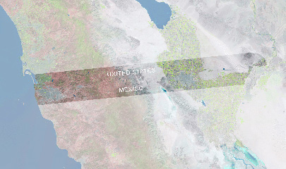
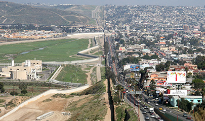
The Advancing Border Connectivity (ABC) project will focus on the South Bay and U.S.-Mexico border region, including the State Route (SR) 11/Otay Mesa East (OME) Port of Entry. A key component of the ABC project includes the development of an advanced transportation system management (TSM) solution that will allow for coordinated operations and management for crossborder travel. This solution is the Regional Border Management System (RBMS) for the new port of entry. The RBMS will use connected vehicle technologies through the deployment of a Smart Intersection System (SIS) along the corridors that connect them.
The project deploys technologies that will make it safer and easier for people and goods to travel to, from, and around the border region. The partnership includes SANDAG, Caltrans, the San Diego Metropolitan Transit System (MTS), the Port of San Diego, and the cities of San Diego, Chula Vista, National City, plus private sector partners including Kimley-Horn and Associates and Parsons Transportation Group. The project is partially funded by the Advanced Transportation and Congestion Management Technologies Deployment Program (ATCMTD) grant awarded to SANDAG in 2021 by the Federal Highway Administration.
Regional Border Management System
A new RBMS will integrate functions such as dynamic lane management, traveler information, border wait time estimation, and dynamic tolling. The RBMS is part of the larger OME project, which is a regional priority. It will serve as the transportation management tool for crossborder travel, helping to:
- Improve border travel and wait times
- Improve border traffic incident management and system resilience
- Improve border traveler information notifications
- Provide a more efficient border network via a tolled approach that will alleviate congestion and enable safe, predictable, and reliable border crossings
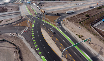
Smart Intersection System
An SIS will include traffic signals along select corridors in South Bay communities that will be upgraded with connected vehicle roadside equipment. Buses and fleet vehicles will have onboard units to enable communication between vehicles and infrastructure to:
- Improve mobility
- Decrease congestion
- Provide transit signal priority treatments
- Provide system-wide intersection-level situational awareness to include the location of transit, pedestrians, and bicyclists to reduce intersection conflicts and improve safety
Anticipated Schedule
- Phase 1: System Engineering and Design (to be complete by spring 2025)
- Phase 2: Concept Deployment (to be complete by fall 2026)
- Phase 3: Concept Integration and Operations (to be complete by summer 2027)